Misty Mountains Wilderness Tracks
-
Email
-
Website
-
Address
Tully Falls Road
Ravenshoe, Queensland 4888, Australia -
Social
Misty Mountains Wilderness Tracks
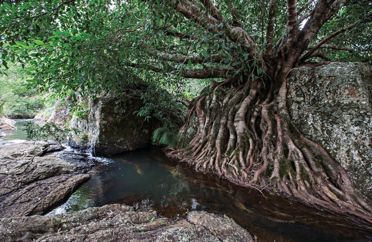
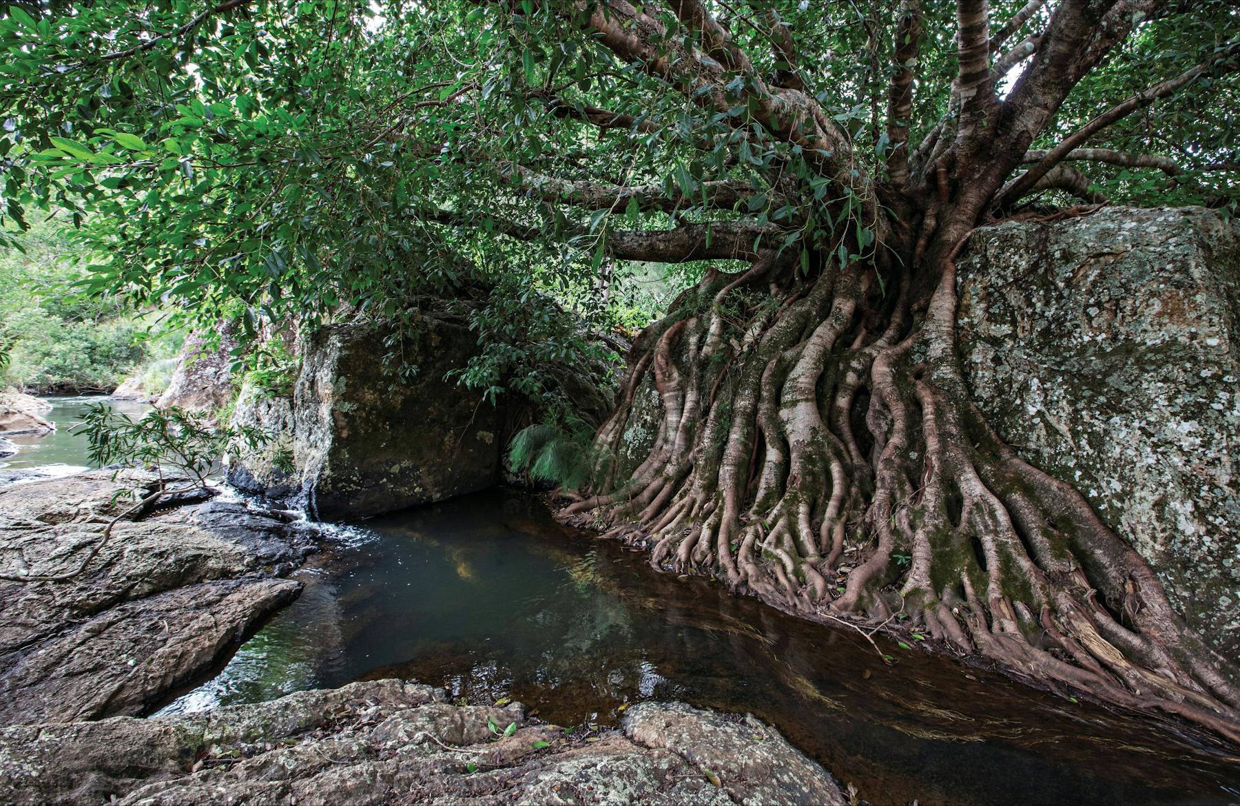
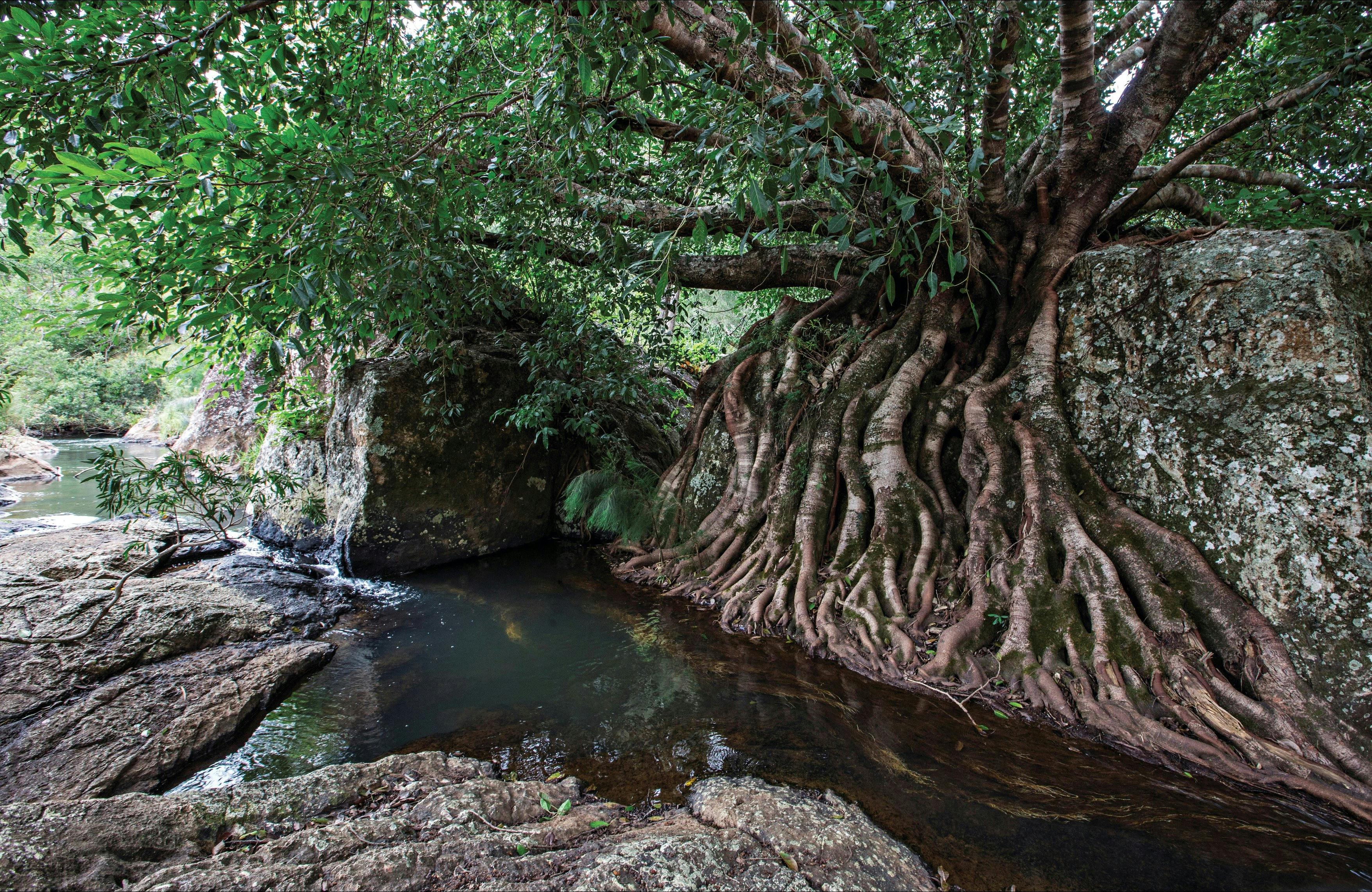
A 130-km network of short and long wilderness tracks takes visitors through pristine, high-altitude rainforest with crystal clear creeks, stunning waterfalls and panoramic views. Some tracks are only suitable for bushwalkers, while others are shared tracks with mountain bikes permitted.
The Misty Mountain wilderness tracks are intended for visitors with advanced bushwalking/mountain-biking and navigation skills. Visitors should carry maps and navigation equipment as they may be required to find their way along indistinct tracks in remote locations.
Tours
Misty Mountains Wilderness Tracks
Delve deeply into the Wet Tropics World Heritage Area along the 130 kilometre network of the Misty Mountains wilderness tracks. The world heritage area is famed for its exceptional natural beauty, outstanding examples of the record of life, evolutionary history and remarkable diversity. Discover lush, high altitude rainforest dotted with crystal clear creeks, stunning waterfalls and panoramic views. Walk, drive and camp throughout the area along four long tracks—Koolmoon Creek, Cannabullen Creek, Cardwell Range and Gorrell tracks—or explore smaller fragments of the tracks. You can even mountain bike along some sections! This walk is managed by the Queensland Parks and Wildlife Service. The map only shows an indicative start point; the track route and end point are not shown, and the map cannot be used for navigation purposes. See www.des.qld.gov.au for detailed maps and the latest park information. When you are in the park, read the signs at and near the start of the track.
Location
Misty Mountains Wilderness Tracks